137
playing with 137MHz weather satellites
introduction
after coming across the saveitforparts youtube channel (and watching every video) i saw how easily and cheaply receiving usable imagary is. i'm personally more interested in the photography than the weather aspect, and these black and white, noisy feeds do have a unique feel to them.
the antenna (and how this works)
APT (automatic picture
transmission) is an analog system for transmitting continuous images over radio -
there are three american NOAA weather satellites that transmit APT signals at around 137MHz, which can
be received very clearly with a makeshift antenna - literally two copper pipes, at 120 degrees, which is
exactly what I did.
APT is a pretty old standard, and provides two low resolution monochrome images, one visible spectrum
and one IR during daytime, and two different IR images during nighttime. it's significantly easier to
get usable images, compared to higher freqency feeds like HRPT.
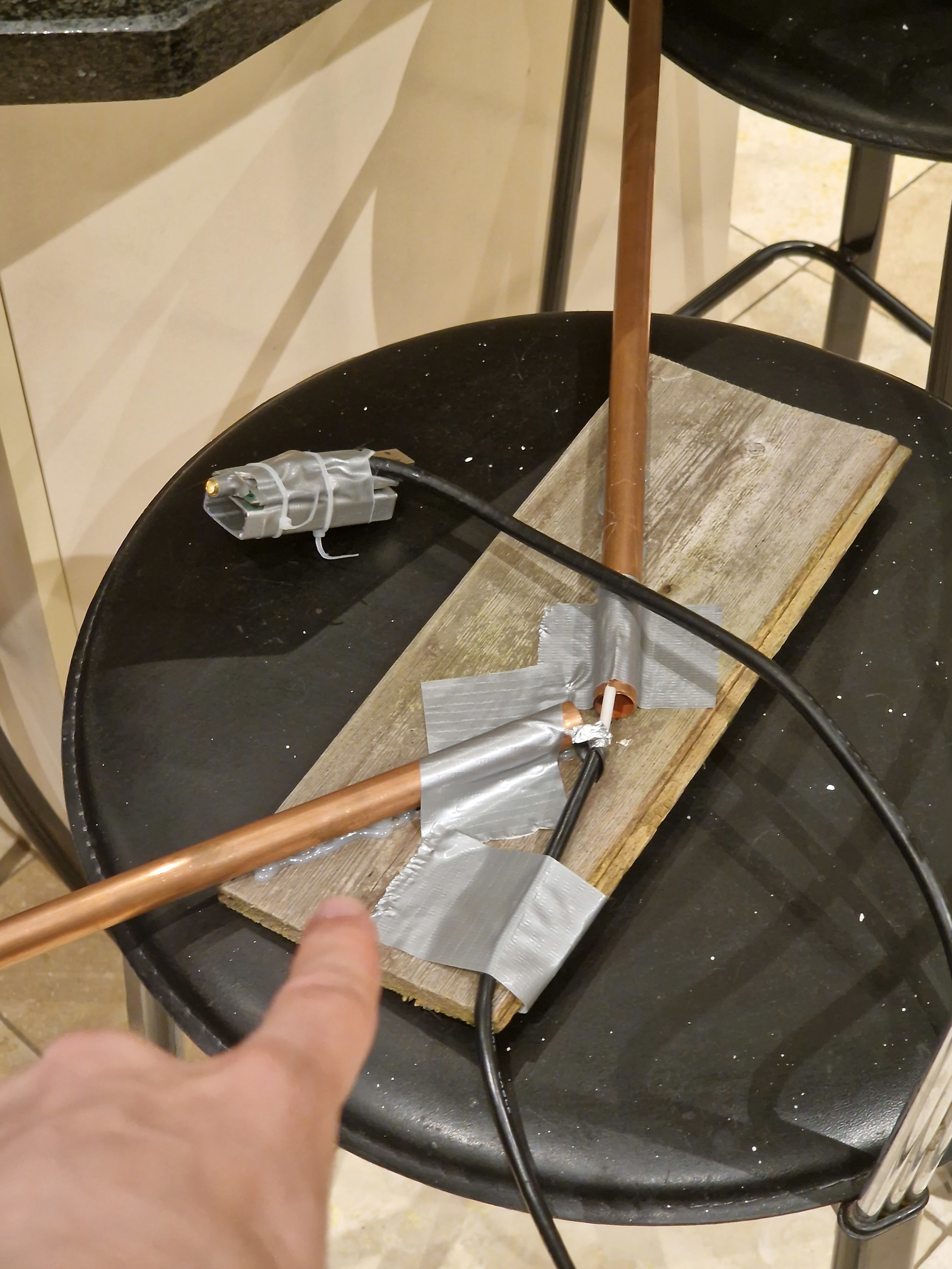
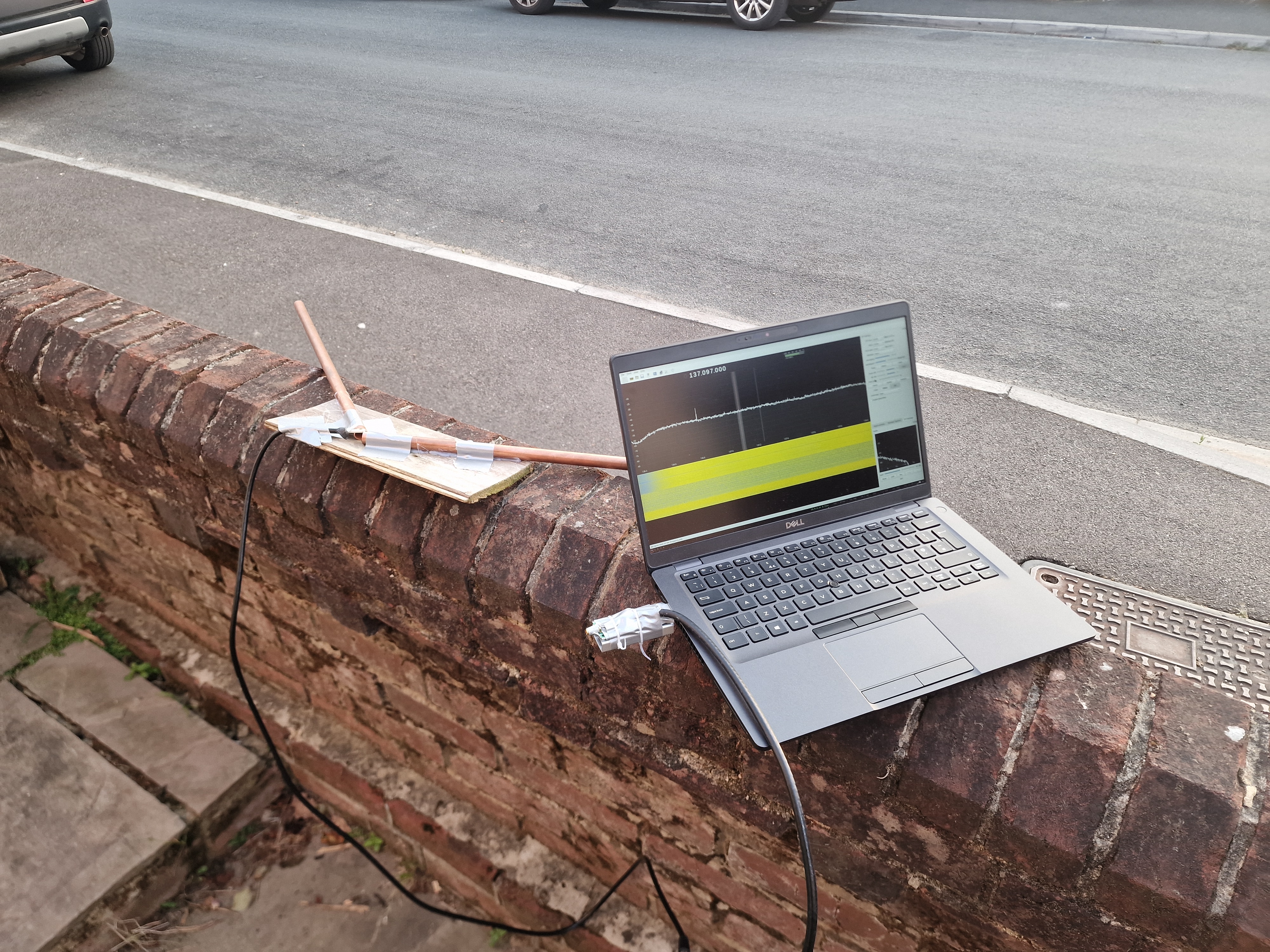
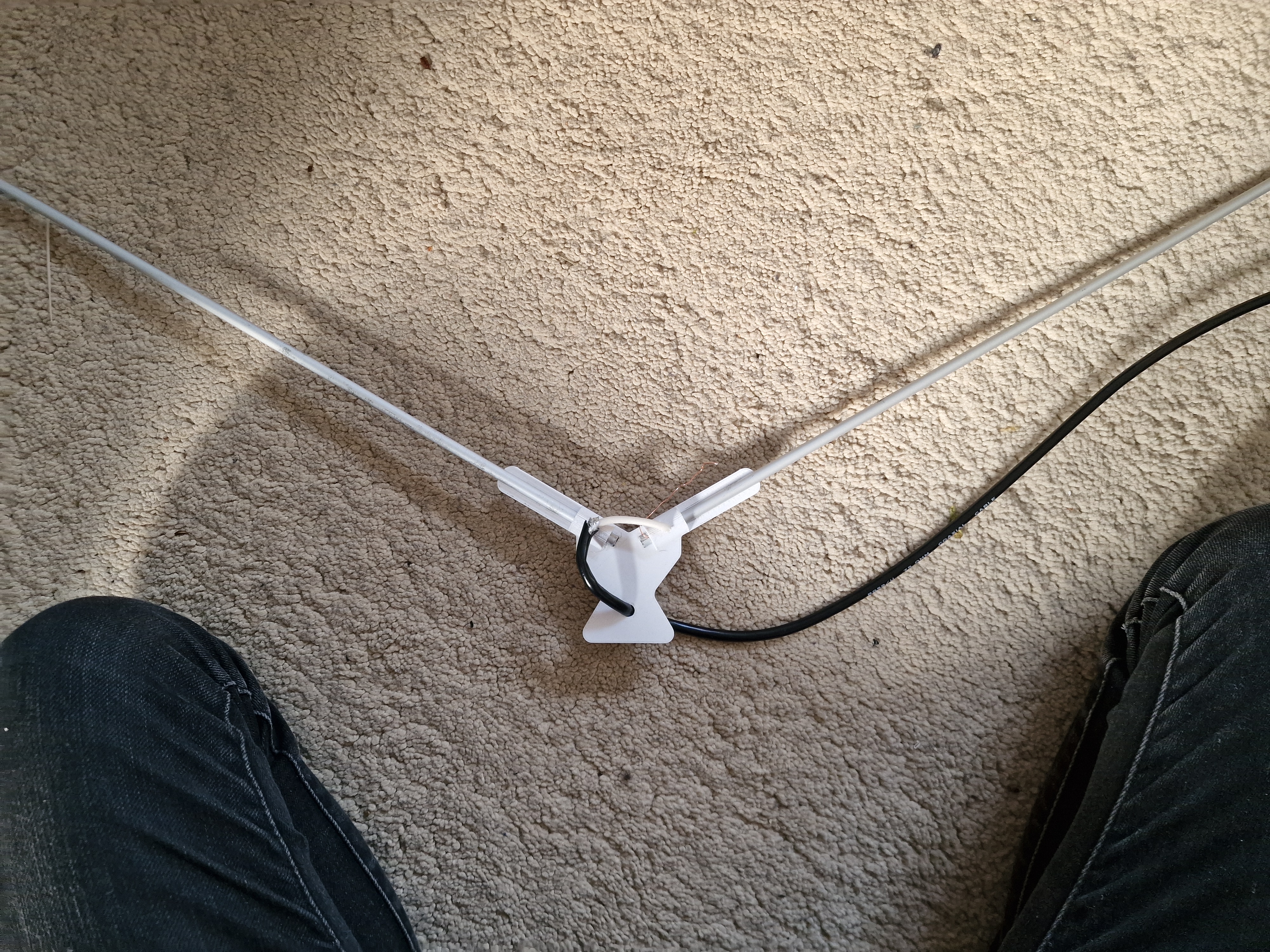
my first antenna was a v-dipole, which is exactly what it sounds like. two poles in a V shape, specifically at 120 degrees and a length of 534mm, which is just under four times the length of a 137MHz radio wave.
first transmissions
unfortunately, the combination of location and imprecise antenna design resuled in pretty poor results. I'm using the open-source GQRX software, on my Arch Linux laptop to record the incoming signals - it's pretty simple, you just have to select your RTL-SDR device, select the right frequency, and hit record. My first pass, i recorded in stereo by accident, which completely ruined any chance of an image. Subsequent passes did end in visible images.
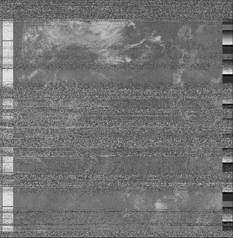
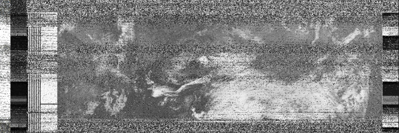
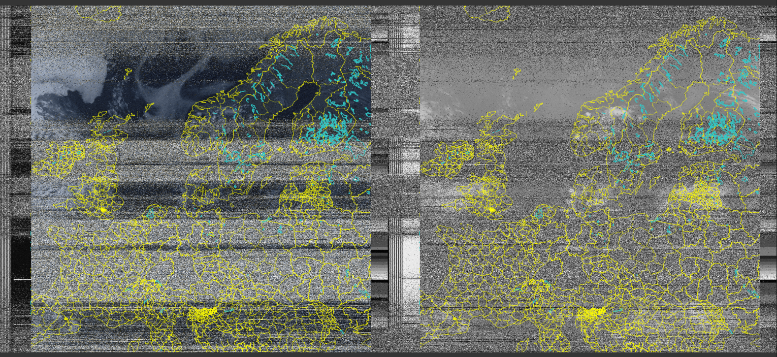
these images are decoded from .wav format into an image by another open source project, noaa-apt. it's a modern alternative to the older wxtoimg software, which is closed-source and no longer supported. noaa-apt supports features like country overlay and false colour, which makes this images much more usable than just the unfiltered monochrome originals.
v2 antenna
after getting half a dozen subpar images, i realised the need for a new antenna - not made out of fence panel and copper pipes. I bought two 3.5mm aluminium rods, and cut them down to the appropriate 534mm. My plan was to 3D print a frame, and solder the COAX cable to the poles, but due my iron or solder being terrible, i couldn't get the solder to stick at all. I instead used the grub-screw holes in my design, to friction fit the COAX copper and shielding. This worked remarkably well.
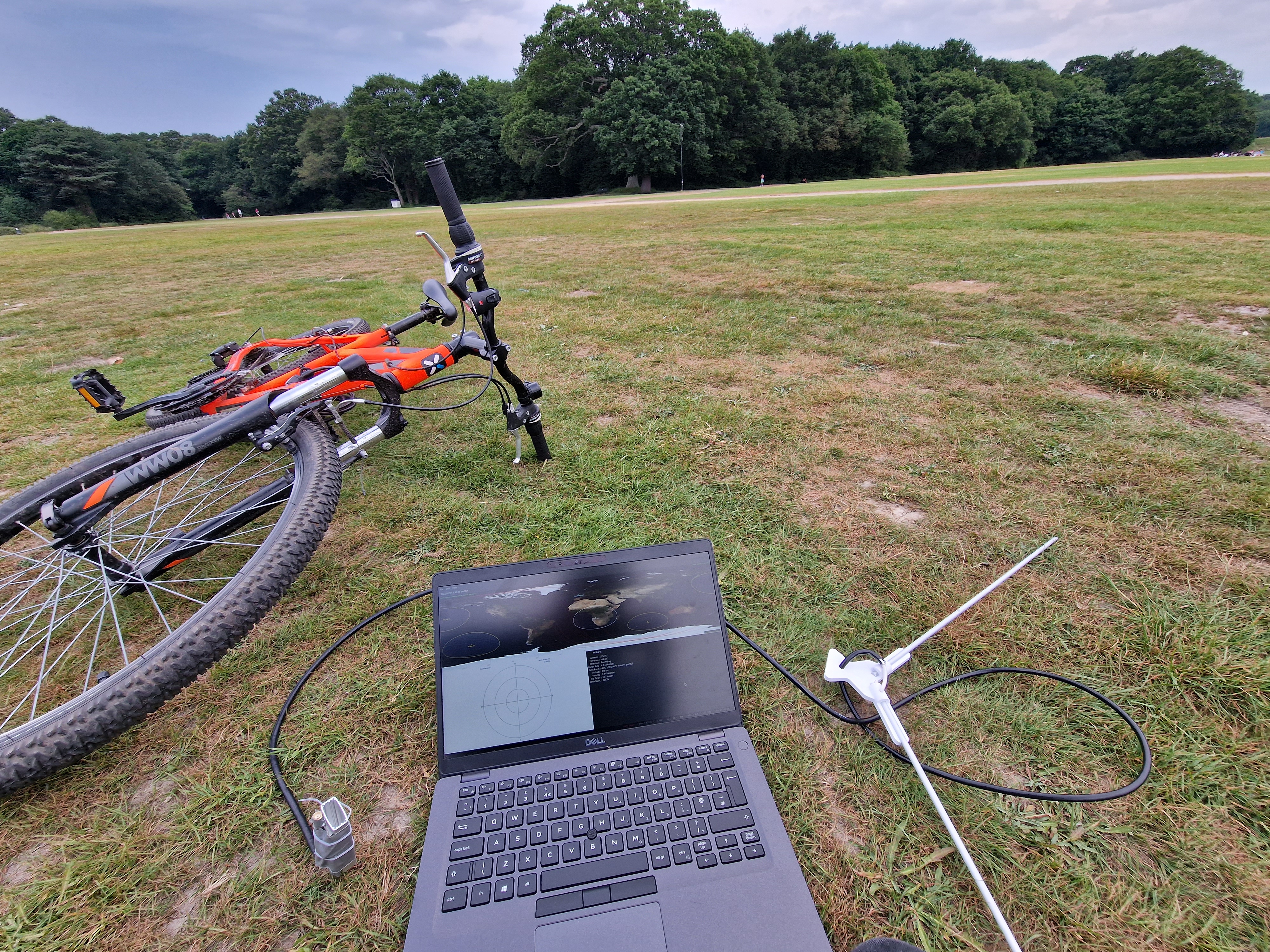
visiting somewhere with clear LOS to the sky, and no buildings or surfaces to reflect signals definitely improved the quality of my images too. - my first pass with the V2 antenna got clear signal from northern africa, all the way to iceland.
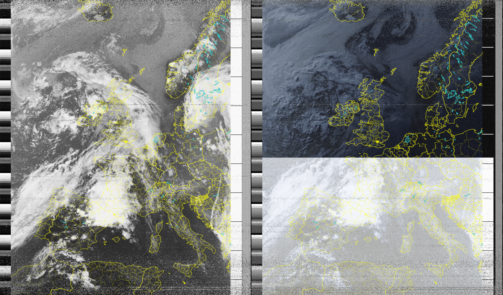
the only issue with this image is the split between IR and visible light - i recorded this at sunset, meaning the lack of sunlight produces a pretty unremarkable image. Passes in the morning or midday should produce better results
composite image
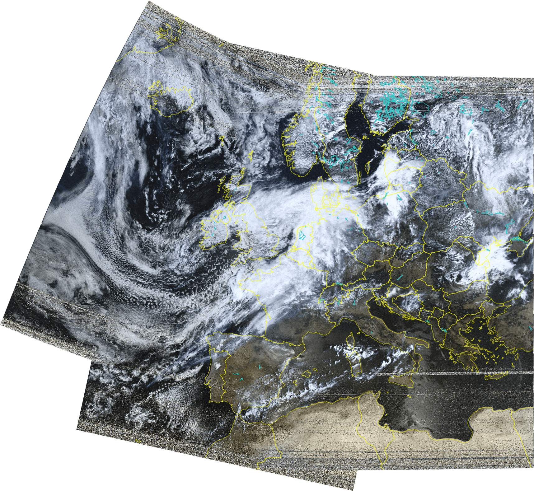
on the 22nd of July, i noticed there were three passes pretty close to one-another. NOAA-15 at 9:50AM, and then NOAA-19 and NOAA-15 at 10:20 and 10:50. The plan is to record all three passes, then combine the images digitally afterwards to create one larger composite. Since all three passes were in the morning, the visibility should be perfect!
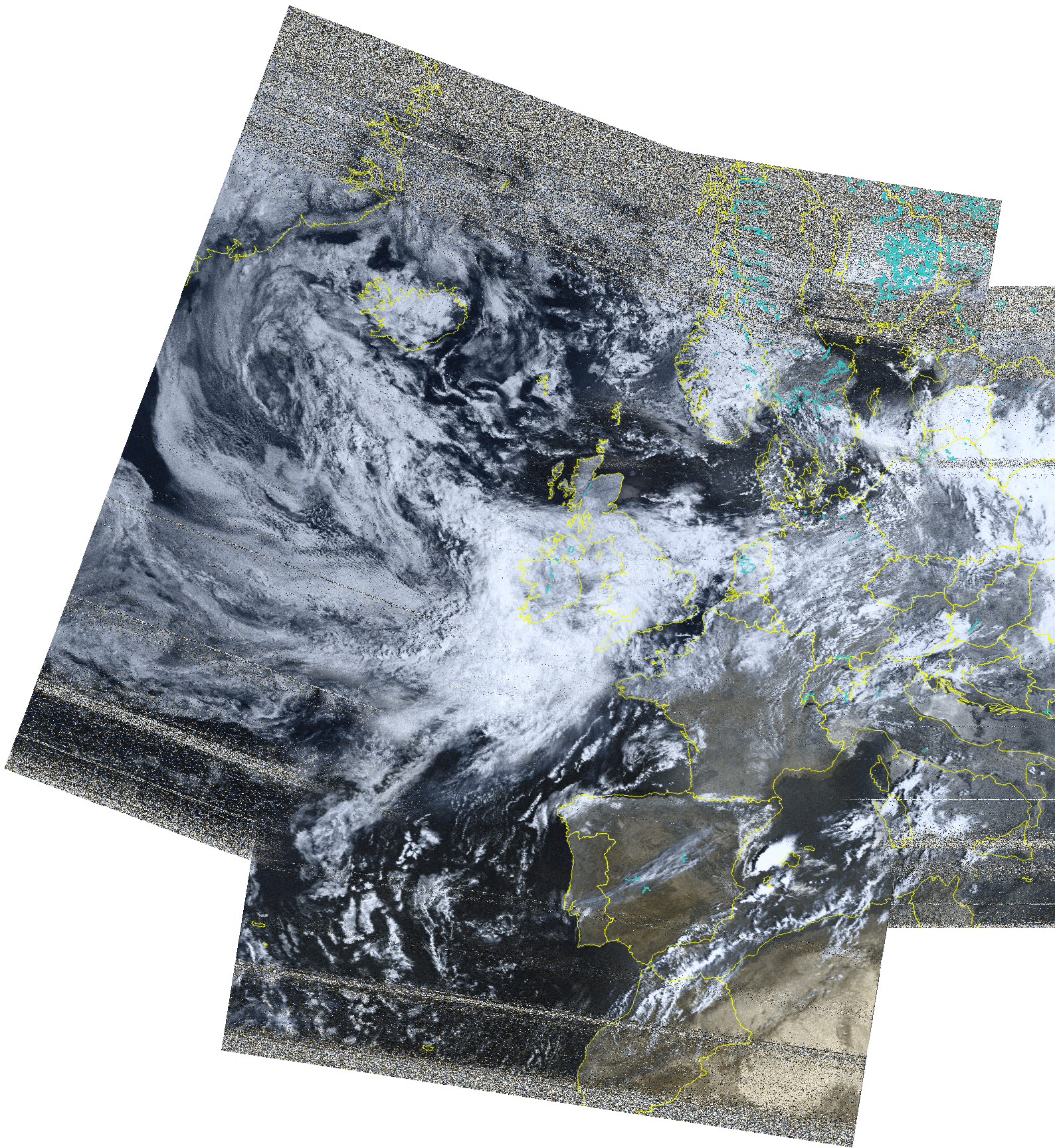
here you can see the three passes were colourised, cropped, then carefully stitched together. I was
very pleased with the width of this image, the NOAA-15 west pass managed to get a significant chunk
of Greenland, and shows some really interesting weather patterns over the Pacific.
i managed to record an even better pass of all three NOAA satellites the next day, going as far east as
Turkey!
